
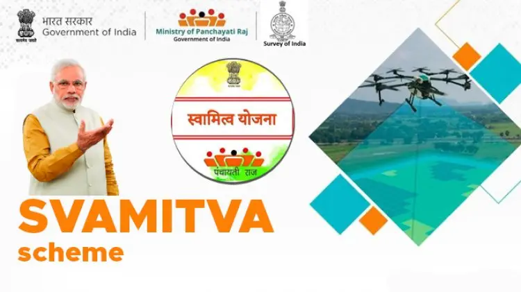
SVAMITVA Scheme
SVAMITVA Scheme was launched as a central-sector scheme to promote socio-economic empowerment and a more self-reliant rural India.
SVAMITVA Scheme
SVAMITVA Scheme was launched as a central-sector scheme to promote socio-economic empowerment and a more self-reliant rural India.
SVAMITVA Scheme
On October 11, Prime Minister Narendra Modi launched the distribution of property cards under the SVAMITVA scheme through video conferencing. The government aims to provide such property cards to each household in the next three to four years in every village across the country.
What is the SVAMITVA card?
The acronym SVAMITA stands for Survey of Villages and Mapping with Improvised Technology in Village Areas. It is a Central Sector Scheme aimed at “providing ‘record of rights’ to village household owners possessing houses in inhabited rural areas in villages and issuance of property cards to the property owners.” The plan is to survey all rural properties using drones and prepare GIS based maps for each village.
The scheme was launched by the Prime Minister on the occasion of National Panchayati Raj Day, April 24, earlier this year and distribution of property cards began on October 11
During the current financial year, the scheme is being implemented as a pilot project in about 1 lakh villages across 8 states – Maharashtra, Karnataka, Haryana, Uttar Pradesh, Uttarakhand, Madhya Pradesh, Punjab and Rajasthan. The aim is to cover all 6.62 lakh villages in the country by the end of financial year 2023-24.
How is a SVAMITVA property card generated?
The framework for implementation of SVAMITVA scheme, finalized by the Ministry of Panchayati Raj, provides a multi-stage process of generating a property card, which starts with signing of a memorandum of understanding between Survey of India (SoI) and respective state governments. The SoI is responsible for preparing the National Topographic database on all scales, using technology for topographical mapping at various scales including the use of airborne photographydrones, satellite imageries, and Unmanned Air Vehicles (UAV) or drone platforms.
Once the MOU is done, a Continuously Operating Reference System (CORS) is established. It is a network of reference stations that provide a virtual base station that allows access to long-range high-accuracy Network RTK (Real-Time Kinematic) corrections. “The CORS network supports in establishing ground control points, which is an important activity for accurate Geo-referencing, ground truthing and demarcation of lands,” says the framework.
The next step is the identification of villages to be surveyed during the pilot phase, and make people aware of the process of mapping properties. The abadi area (residential area) of the village is demarcated and each rural property is marked with limestone (chunna). Then, drones are used for large scale mapping of rural abadi areas. Based on these images, a GIS database on 1:500 scale, and village maps — Gram Manchitra — are drawn. After creation of maps, a ground verification process by drone survey teams follows, on the basis of that corrections, if any, are made. At this stage, inquiry/objection process – conflict/ dispute resolution is completed. After this, final Property Cards/Title deeds or “Sampatti Patrak” are generated. These cards will be available on digital platforms or as hard copies to the village household owners.
How will the SVAMITVA property data and maps be updated in the future?
The framework states, “Once the GIS database is prepared encompassing the 6.62 lakh villages, state governments will be responsible for conducting future surveys and updating the GIS database.” They will also decide the update frequency of the re-survey.
Who will own the SVAMITVA data?
According to the framework, the orthorectified base maps shall be jointly owned by the Survey of India, Ministry of Panchayati Raj and the state government. The GIS data will also be jointly owned by Centre and State. However, the data related to property details will be owned by the State Revenue Department as it has the authority to mutate the Right of Records (RoRs) and update the maps. Hence, the State Revenue Department will be the owner/host of this data and others will have a right to view. Other updated GIS data layers will be shared by the “Talathi/Patwari” level officer once every year incorporating updates that have been done in the preceding 12 months.
What is the benefit of issuing a SVAMITVA property card?
According to the Ministry of Panchayati Raj, which has piloted SVAMITVA, the scheme will benefit rural residents in many ways. First, it will enable rural households to use their property as a financial asset for taking loans and other financial benefits. Second, it will help in determination of property tax, which would accrue to the Gram Panchayats directly in states where they are empowered to collect such taxes. The cards will help increase liquidity of land parcels in the market and increase the financial credit availability to the village. The scheme will also pave tje way for creation of accurate land records for rural planning. All the property records and maps will be available at Gram Panchayat, which will help in taxation of villages, construction permits, elimination of encroachments, etc.
The property maps will be made using the GIS technique and the same can also be used for better-quality Gram Panchayat Development Plan (GPDP).
Activities under SVAMITVA Scheme
The main activities under the Scheme are:
- Establishment of Continuous Operating Reference System – CORS is network of reference stations that provide a virtual base station that allows access long-range high-accuracy network RTK corrections with centimetre-level horizontal positioning in real-time. CORS network supports in accurate Geo-referencing, ground truthing and demarcation of lands.
- Large Scale mapping using Drones – Rural inhabited (abadi) area would be mapped by Survey of India using drone Survey. It would generate high resolution and accurate maps to confer ownership property rights. Based on these maps or data, property cards would be issued to the rural household owners.
- Awareness program to sensitize the rural population about the surveying methodology and its benefits.
- Setting of Programme management unit at National and State level.
- Development/ Maintenance of Scheme Dashboard and integration of drone survey Spatial data/maps with Ministry’s Spatial planning application to support in planning at local level.
- Documentation of best practices/ conducting National and Regional workshops
Objectives of SVAMITVA Scheme
Given below are the main objectives of the SVAMITVA Yojana:
- This will bring abut financial stability among the people living in rural areas as the land/property can be used as an asset to get a loan or enjoy any other financial benefit
- Because of lack of knowledge, the land division and records are not well maintained and noted. Through this scheme, the Government intends to create accurate land records for rural planning
- It will help in the determination of property tax, which would accrue to the GPs directly in States where it is devolved or else, add to the State exchequer
- For the use of various Government departments, proper survey infrastructure and GIS maps shall be leveraged
- This will also improve and support the Gram Panchayat Development Plan (GPDP) by making use of GIS maps
- A lot of legal and property-related disputes are still pending in the rural areas. This project will also help resolve these issues
To know the Difference Between Gram Sabha and Gram Panchayat
Benefits of SVAMITVA Scheme
- Official documents for the property will be provided to the rural people so that they can use it for further financial purposes
- Through regular inspections, and survey via drones will give the Government and the authorities a clearer idea of the land/property distribution
- A clarity on property rights will be attained through this project
- No illegal attempt to grab someone else’s property in the village will be practised once stricter rules and documents are provided
- The SVAMITVA Property card can also be used as a temporary identity for the land-owners
Scope of the Scheme
- All villages in the country which will be eventually covered in this scheme. The entire work is likely to be spread over a period of five years from April 2020 to March 2025.
- Pilot Phase of the Scheme implemented in FY 2020-21 covered States of Haryana, Karnataka, Madhya Pradesh, Maharashtra, Uttar Pradesh and Uttarakhand, Punjab, Rajasthan and Andhra Pradesh and CORS network establishment in the States of Haryana, Punjab, Rajasthan and Madhya Pradesh.
, candidates can visit the linked article.
Need for the SVAMITVA Scheme
The Government is constantly working for the development of the rural Indian population and the Survey of Villages and Mapping with Improvised Technology in Village Areas (SVAMITVA) yojana is also an initiative for the same.
-
- Once the pilot project is a success, over 6 lakhs rural people will be able to benefit through this scheme
- The ‘record of rights’ would be provided through the land/property registrations done through this scheme
- This would facilitate monetisation of rural residential assets for credit and other financial services